|
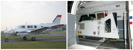
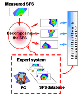
Technology The World's First FLS-LiDAR Oil Sensing Laser System Light Detecting and Ranging (LiDAR) technology started in the 1960's with NASA and other research institutions. LiDAR is similar to RADAR with the exception that LiDAR not only can tell you distance from and location of the target, but also, the composition of the target. Dr. Sergey Babichenko and Dr. Larisa Poryvkina, internationally recognized authorities on LiDAR (70 publications and presentations at leading forums on LiDAR technology) have advanced the LiDAR technology by adding a high resolution / low altitude airborne Fluorescence Laser System (FLS) to the LiDAR, creating the proprietary "FLSTM LiDAR", thereby converting "Star Wars" LiDAR technology into a system that will benefit mankind. The FLSTM LiDAR system has been used to demonstrate its capabilities for detection and measurement of oil in over 20 independent projects around the world ranging from single tests to 10 year projects. How does it work? The FLS-LiDAR has been developed over the last 20 years to detect oil with high degrees of accuracy and precision in real time using airborne systems that can monitor substantial geographic areas in short periods of time. The LiDAR captures the distinct Spectral Fluorescence Signatures (SFS) that are emitted by the oil when exposed to the LiDAR's own light source. The light produces this fluorescent response which is detected and recorded by the LiDAR. Because each compound has a unique SFS, precise measurement of the type, concentration, and age of oil is captured. By comparing SFS detected by the instrument to an extensive SFS library that has been developed over 20 years of testing, the LiDAR can distinguish the type and concentration levels of oil on the ground or water surface and also how long the oil has been there. No other instrument available today can match the level of performance of PXI's proprietary FLS-LIDAR technology. 

|